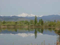
 One citizen's view of Longmont, Colorado, USA.
 | |
| Longmont Ledger Advertisement, June 20, 1902 |
[Edit: February 7, 2018: A follow-up with a site visit to Noland has been posted here]
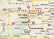
Noland, Colorado, a few miles northeast of Lyons, and twelve miles west of Longmont was once a thriving quarry town of 1,000 (some reports say 3,000) people in the 1890's, with a railroad, a post office, a prized schoolhouse, two general stores, a justice of the peace, and five saloons with gambling on premises. Noland's original name was "Tower" but this name was never formalized with legal papers. Long vanished, there is reportedly no trace left of Noland today although we can't tell for sure because the townsite is on private property.
Noland, Colorado, a few miles northeast of Lyons, and twelve miles west of Longmont was once a thriving quarry town of 1,000 (some reports say 3,000) people in the 1890's, with a railroad, a post office, a prized schoolhouse, two general stores, a justice of the peace, and five saloons with gambling on premises. Noland's original name was "Tower" but this name was never formalized with legal papers. Long vanished, there is reportedly no trace left of Noland today although we can't tell for sure because the townsite is on private property.
Two excellent articles are available about Noland. One was written by Bernard Faller, Jr. in the September 30, 1959 edition of the Times-Call. This article is significant because was still able to quote people who experienced Noland, growing up in the area. One such interviewee hauled groceries up to Noland from Lyons as a teenager. In 1995, Diane G. Benedict wrote a comprehensive piece about Noland which appeared in the Boulder Genealogical Society Quarterly, November 2000. Both articles include photographs if you want to get a glimpse of Noland.

Where was Noland? It sat above Lyons, in a stark area about four miles to the north, between Indian Ridge and Stone Mountain. Unlike other area mining towns which were started by precious metal speculation, Noland was all about quarrying sandstone. In 1890 at the county courthouse in Boulder, Noland was platted with named streets and surveyed lots. The sandstone industry was booming and tons of it was being shipped out of Noland daily to places like Denver and the University of Colorado, where it was being used for sidewalks and buildings.
A five-mile railroad was completed by the Stone Mountain Railroad and Quarry Company in 1891 connecting Noland with the Burlington and Missouri Railroad down below. A short description of this railroad appeared in a 1901 coal mining publication called The Colliery Engineer:
At Noland, adjoining Lyons, is a remarkable railroad for 5 miles of standard-gauge track, 6 per cent, grade with 45° curves. The motive power is a 30-ton locomotive of "Shay" pattern. Standard-gauge freight cars laden with stone are propelled daily over such grades and curves.
In a report presented to the 1893 World's Fair in Chicago by the state of Colorado, the population of Noland was given as 300. Coincidentally, Noland sandstone was used in the some of the buildings at this Fair.
Two large buildings were constructed in Noland to house and feed the hundreds of mostly bachelor quarry workers - the Matthew and Nebraska Houses. Faller (mentioned above) reported that these structures were still partially standing into the 1950s. Like clockwork on pay days, roving professional gamblers came into town setting up card games and roulette wheels. And, the Matthew House had a large dance hall upstairs.
Other Noland tidbits:
- The town had a band (Noland Band) that was well-respected and played throughout the state. On a summer night before the turn of the century, the band climbed on top of Hogback Mountain to serenade the citizens of Lyons below. The music was faint but this event was always remembered.
- Despite the handful of saloons and no churches, Noland was a civil town and there were no serious crimes committed there.
- Eight grades were taught in the one-room Noland schoolhouse.
- Long before Noland, the area was used as a lookout point by Native Americans. The surrounding land contained burial grounds, artifacts, and writings on the cliffs. Unfortunately, all of it was hauled away over the years without getting documented. It was actually a Noland Sunday afternoon pastime for the men of the town to search for such artifacts.
With its railroad and high demand for sandstone, Noland was assured of a bright future. What went wrong? A few key events and tragedies have been attributed to its demise, along with a lack of a solid water supply. In 1891, four railroad workers were killed when they were ejected from a runaway car on the dangerous downhill switchbacks during a brake failure. Shortly after, a quarry worker was killed in a separate accident, and these incidents were not forgotten by the townspeople. Some thought the town was jinxed.
For Noland to mature into a real town, it needed a solid water supply, which it didn't have. To get by, water was being hauled by railroad cars from the St. Vrain River on the return trip up the hill. A water diviner was hired to locate a water source. He found a location but unfortunately it was smack in the middle of Main Street which was not a good spot for a well! They dug a few feet away to a depth of 125 feet but it came up dry. The well shaft was put to use anyway as a refrigerator and into the 1950's, was still dry and covered up by wooden planks. It is likely still there today.
The final nail in the coffin for Noland started with the experimental paving of a small section of a street in Bellafontaine, Ohio in 1891 with cement. It was a success and quickly caught on with other towns. In 1906, the process for mixing cement on-site became workable. It was cheaper and faster for construction and the demand for rock plummeted. Work stopped in the quarries, the railroad company terminated the service to Noland, and the gamblers stopped showing up on paydays. Eventually, houses were deconstructed and the lumber hauled off. The post office closed in 1918 and the railroad tracks were soon lifted up and moved to Oak Creek, Colorado near Steamboat Springs, as Benedict writes. My friend Ron reports that the tracks were bought by the Routt-Pinnacle Coal Company to build a siding to one of their mines. I wonder if these tracks from Noland are still there?
Ironically, as Ron pointed out to me, cement likely lead to Noland's decline and and today Lyons has a large cement plant just down the hill from Noland that dominates most of the railroad traffic on the Lyons branch. Also, sandstone did make a comeback (today with some long waiting lists) in the Lyons area but Noland was not part of the revival.
The town site of Noland is on private property and is off-limits to curious potential visitors like myself or you. In 1958, Dr. Robert Kline and his wife purchased 1800 acres of the Noland area including the town site itself, for the purpose of cattle grazing and some quarrying. The Klines put the property up for sale in 1978 and there was some talk of Boulder County buying it for open space but that did not happen.

Today, you can find the entrance to the road (and railroad of the past) to Noland at Stone Canyon Road shortly after you enter Lyons city limits on US 36. Stone Canyon Drive will be on your right. Apparently this entrance used to be gated off at US-36 but you can enter the road now, as there is some residential development just up the road:

The paved road continues for a while past the houses and then turns to dirt. You can imagine the railroad tracks heading up this path.

The dirt portion of Stone Canyon Drive is accessible for a little bit:

Until you run into this, and I had to stop! You'll notice that the Noland name ("Noland Home Owners Association") lives on, in this sign:

How far was I from Noland? Benedict helpfully listed the latitude/longitude of Noland in her article and this map shows that I still would have a little way go on the road:

The Google Map is here if you want to experiment with it. Since we can't get to the site, we'll have to rely on Google Earth to show it to us. The town of Noland should be right where the 40 15' 33" N 105 15' 14'' W label is, in the picture below. That's the Larimer County line running horizontal to the north. You can see Stone Canyon Road to the left of the town, and also some existing sandstone mining to the left of that.

And another of the same view, zoomed out, that may better show Noland positioned between two ridges.

Pat Jorgenson of the Times-Call was able to get onsite to Noland in 1978, and wrote in an article of finding nothing other than a few foundation remnants. It would be interesting to see if anything remains at Noland 33 years later.
Some other neighboring historical communities in the Longmont area:
Highlandlake
Ryssby
Pleasant View Ridge
Canfield and the connecting railroad to Longmont
Liberty Hall

5 comments:
Fascinating! It is a shame that Noland isn't a visit-able site today.
Outstanding post! I biked up that road several years ago. I don't recall any signage until reaching the, at the time, still working quarries (up in the trees). From your map it looks like I rode right past the Noland site. I wasn't aware of Noland at the time and didn't notice anything.
Thanks! Look for an update to this post soon, based on some better information I've received about Noland. The history is right, we think the road is incorrect1
I recall a news article in the 90's about the last person born in Noland at 100 years old
Does anyone know who Noland was named after?
Post a Comment