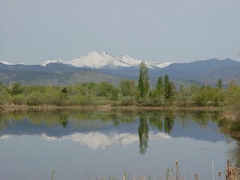
 One citizen's view of Longmont, Colorado, USA.
Lefthand Creek begins high up on Niwot Mountain and makes its 30 mile journey to where it meets the St. Vrain River in Longmont, not too far from the Recreation Center and Museum. For most of the year, it has a gentle, steady flow but for a few weeks in June during peak snow melting season, it flows fast and occasionally high thus putting some of Longmont in a 100 year flood plain, especially the Southmoor Park neighborhood. The last problem flooding here occurred in the mid-1990's when some streets and basements were flooded.
The City has a substantial construction project in the works right now to widen the Lefthand Creek channel, to improve flow for when the next time one of those 100 year events occurs. As part of this effort, the existing bridge on South Pratt Parkway and Missouri Avenue had to be torn down, to be replaced by a longer one, and perhaps higher arching over the creek.
First, let's look at the bridge on it's last day (October 30, 2011) of operation before being closed off:
 |
| Construction fencing is up. Countless schoolkids over the years have crossed this pedestrian bridge to get to Burlington Elementary |

 |
| Looking south over the doomed bridge |
What a difference one week makes. On November 5, the creek channel widening had begun. The bridge still exists, but just barely.

 |
| Looking north over the bridge to the other side. Burlington Elementary School is off to the left, past the barricades |
 |
| Sign advising of the closed road time frame. There are some rumors now that the construction will need to continue into February |
 |
| On the other side of the creek, now looking south |
Meanwhile, a little upstream from the bridge, close to Pike Road, trees and brush have been removed from the creek bank on the left hand side of this picture. I wish I had taken a "before" picture! Definitely looks barren now but the project includes the replanting of trees when the widening is completed.
 |
| December 11, 2011 |
Back to the bridge area today (December 18) on a very warm and pleasant day, where there is no trace remaining of the bridge.


A similar look across the construction, just like above. Creek flow is being diverted through a temporary tunnel which you can see on the left, where the black plastic is. They are trucking off the evacuated soil from the widening, and I was thinking that whoever the receiver is, they are getting very fertile bottom-land earth!

Ducks are common in this slow-moving creek, and life goes on for them despite the major construction disturbance.

Here I'm standing on the pedestrian bridge into Kanemoto Park, just a little upstream from the South Pratt Parkway bridge area, looking both ways: first downstream and then upstream. This area has not been impacted yet by the widening.


I'll be watching this project and will get some more pictures, especially as the replacement bridge starts to go up.

No comments:
Post a Comment