Showing posts with label canfield. Show all posts

Monday, December 29, 2008

Someday in the future: a trail between Erie and Boulder

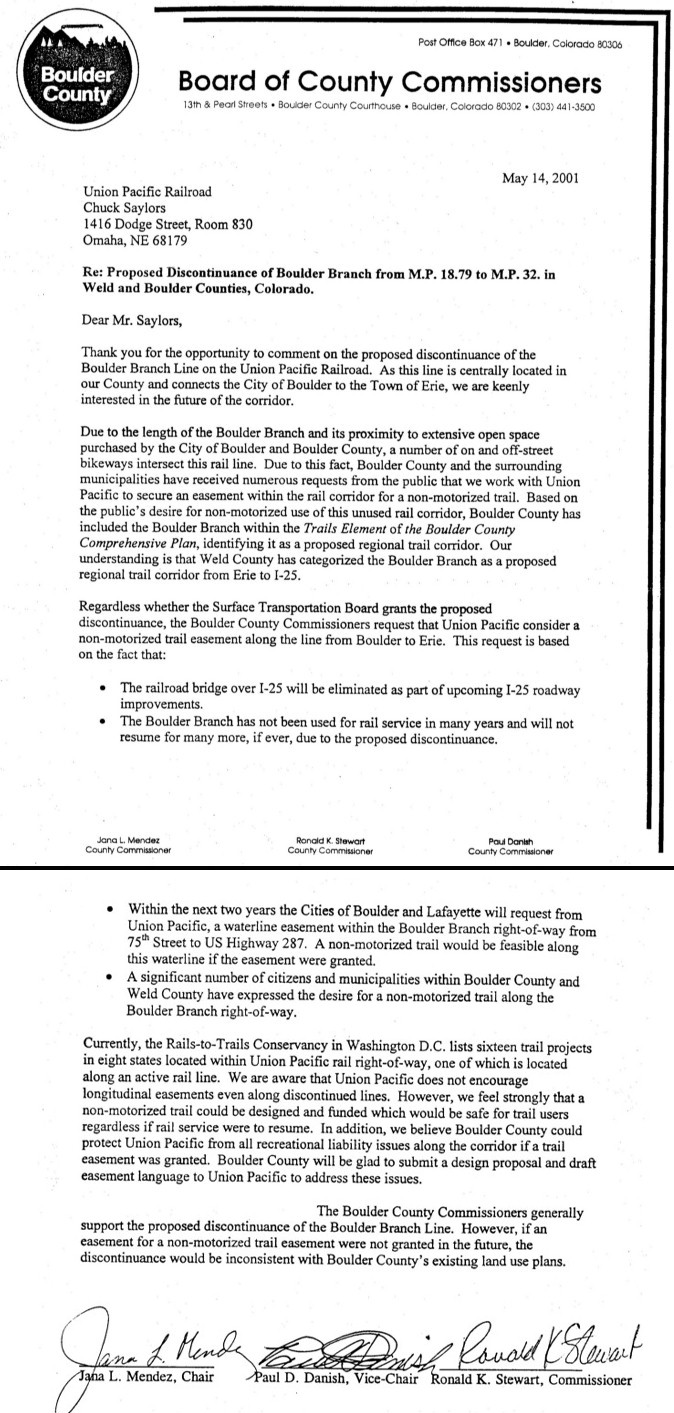
Almost a year ago, I wondered what would become of the abandoned Union Pacific railroad line between Erie and Boulder.


It was good to read an article in today's Daily Camera that says plans are underway to convert this to a trail, by the year 2015. The big challenge will be getting this trail across the major north/south highways, like 95th Street and US-287.


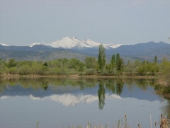
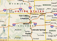
(Both pictures here are about a year old and from the Erie/Canfield area)

Saturday, February 2, 2008

Longmont's "Baby Railroad" (1881-1889)

It's a little known fact that one of Colorado's first narrow-gauge railroads originated right here in Longmont, in the early 1880's. The story starts with some Longmont businessmen who were not happy with the "outlandish" high price of coal that Longmont was getting from the Marshall area, near Boulder. A good coal supply, obtained at a reasonable rate, was crucial to the survival of any Colorado town back then. With the discovery of the rich Rob Roy coal seam in the Canfield area, a railroad company was incorporated in 1878 with the chief purpose of getting coal to Longmont at a better price. Isaac Canfield himself was listed in the incorporation papers of the railroad known as the "Denver, Longmont, and Northwestern" line.

The narrow gauge railroad was opened on November 24, 1881 and consisted of 8.2 miles of track between Longmont and Canfield. Leaving Longmont at Main & 2nd Avenue, the route went up over Empson Hill and crossed the St. Vrain and Boulder Creek on the way to Canfield. One-way trip time was 45 minutes.

The map above is from 1904, many years after the Baby Railroad was gone, but you can use it to imagine where the route used to be (Canfield is next to Erie) and you can also see the Marshall coal fields down by Superior.

A picture is here from the Longmont Museum, showing a model of what the locomotive looked like on this railroad line.

A few weeks later, in early 1882, the railroad was extended from Canfield to meet the larger Denver, Utah, and Pacific railroad line which opened up additional opportunities beyond just moving coal. Suddenly, Longmont citizens had a convenient way of getting to Denver at a cost of $2.50, for business and leisure. Excursions, Phyllis Smith writes, "were the main entertainment of the 1880s. " The trip time from Longmont to Denver was 1 hour, 35 minutes and horses belonging to passengers could be transported for an additional 40 cents. Rock quarried in Lyons was transported to Denver on this railroad, for their sidewalks and buildings. Longmont received visitors to local festivals such as early instances of the Pumpkin Pie Day and the Firemen's Masquerade Ball, on this train, and vice-versa, our residents ventured to ice skating contests and band concerts in the Canfield/Erie area. Clearly, the railroad had evolved to serve a much larger range of uses than its original charter.

What happened to Longmont's Baby Railroad? Competition swept in when the Colorado Central, owned by Union & Pacific, fought back with lower freight and excursion rates (50 cents from Longmont to Denver, through Golden). The operating company of Longmont's Baby Railroad was eventually bought out and in 1889, the narrow gauge tracks between Longmont and Canfield were ripped out.

Someday in the next decade, RTD's FasTraks will again offer Longmont residents a rail trip to Denver via Boulder. Will this perhaps kick off another "excursion age"?

Most of this information came from an excellent article in the November 23, 1981 Longmont Times-Call newspaper, written by Linda Burleigh, and also from Phyllis Smith's "Once a Coal Miner" book mentioned previously.

[Edit on December  18, 2017:  Modernize the font]

Sunday, January 20, 2008

Canfield, Colorado

The Colorado state map in the Hammond's Complete World Atlas from 1952 shows the usual, familiar towns of Longmont, Boulder, Lyons, and Hygiene in Boulder County but it also shows a place called Canfield right on the eastern county border.

We've all heard of Broomfield. Where's the town of Canfield?

A little bit of digging showed that Canfield was named after Isaac Canfield, a promoter who discovered a coal seam around the year 1873 which he and his brothers named the "Rob Roy". (There appear to be multiple mines with this name; another one was in the Sugar Loaf area in the foothills. Let me know if you know any significance to this name). The town named after him was platted in 1875, and got a post office in 1878. Unfortunately, Isaac Canfield's mine did not do well under his operation, with the failure attributed to striking miners just at the time when there was a good market for coal. The mine had coal but they just couldn't get it out due to the labor problems. He lost everything , exited the coal business, and left the area. Canfield's coal mining investment partner, the proud banker H. T. West of Greeley who put in $12,500 and an additional $18,000 of collateral, was also left penniless and suffered mental and physical problems after this ordeal. Canfield would be heard of again when he returned to the area twenty-five years later to take part in the next boom, the oil drilling business.

For more information on coal mining in the Boulder County area, a good book on the subject is "Once A Coal Miner" by Phyllis Smith from 1989.

In the 1880s, there would be a very important connection between Canfield and Longmont in the form of one of Colorado's first narrow-gauge railroads, sometimes called Longmont's "Baby Railroad". This story is good enough that it will get written up separately in the next posting. In 1887, the recorded population of Canfield was 153 people.

Although Canfield no longer appears on any printed maps today, in 1984 it was listed along with Boulder and Longmont as "still alive" in the book "Atlas of Colorado Ghost Towns"by Leanne C. Boyd and H. Glenn Carson. Google Maps still knows about Canfield, too. You can see what's left of the Canfield area if you take Jasper Road east from US-287, toward Erie.

View Larger Map


The Canfield crossroads, at Jasper Road and 119th Street, looking northeast. County Road 1, the border between Boulder and Weld counties, is not too far away from here


Looking east, the wall of development from Erie appears to be closing in on this area. Similar development is approaching from the city of Lafayette to the south.


On Jasper Road looking west at the intersection with 119th. The cluster of mature trees on the left part of the picture shows the location of Canfield, which was annexed by Erie a while ago.


The abandoned Union Pacific (formerly Denver and Boulder Valley Railroad) rail tracks just south of Canfield, looking west. This is marked on the Hammonds 1952 map above as the red line labelled "180" between Boulder and Erie). You may remember these tracks being removed from US-287 a few years ago (update on January 23: the tracks are still there across US-287 - what was I thinking?). There was some "rails to trails" activity for this railroad a while ago. Anyone know the status of it?


Same tracks, going east:


There are definitely some interesting buildings and structures in this area, most of which were probably around in Canfield's more populous times.