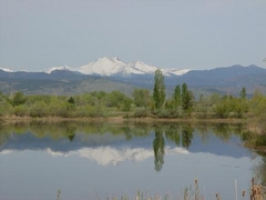
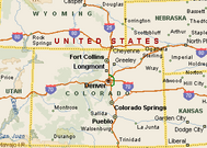
 One citizen's view of Longmont, Colorado, USA.
One of the rewarding things about posting Longmont-area history stories is hearing from readers who experienced it first hand! Patricia contacted me and said that she was in one of the elementary school classes that transferred during the school year from the Beasley School (previously unknown to me) to the brand new Niwot Elementary School 50 years ago in March 1967. (See 50 Years for Burlington, Niwot, and Erie Elementary Schools for more about that.)
Patricia said:
Where was the Beasley School? Patricia provided me with the location: one-half mile west of US-287 on Niwot Road, making it easy to find on an early 1950s map.
The Beasley School was first built of wood in 1896 and then later of brick in 1907. It was named after James Jackson Beasley (1831-1907) from Missouri who homesteaded in the south Longmont area in 1871 and formed school district #42 with his neighbors. The formation of a school district required at least ten children in the area, ages 5 to 21 years, and each district was governed by a three-member school board. The Beasley School board always included at least two Beasley brothers or a brother-in-law.
A early 1920s picture of the Beasley School (courtesy of the Longmont Museum Photo Collection) shows the school before an addition was made to the east side of the building:

Rural schools here were usually built on donated land, facing south or east for protection against the winds from the west. The trees above appear to be leaning east for that reason.
A 1966 (grainy from microfilm copy) Beasley School photo from the Longmont Times-Call shows the two teachers at the time, Evelyn Delzell (2nd Grade) and Louise Parks (1st Grade), one year before the school closed and transferred to the new Niwot Elementary. By this time, Beasley was part of the consolidated St. Vrain Valley School District but the historic District #42 sign remained. Ms. Delzell was in her fourth year at Beasley, Ms. Parks in her fifth and she was at the old Burlington School for 15 years prior.
Notice the differences from the 1920's picture above, including the eastern addition, no more door overhang, and the additional brick above the door.

Patricia says that the school playground (with a sit-down merry go-round) was to the left of these steps and perhaps it was recess time or after school when the two curious children above were watching the photographer.
As you can see, the school had a basement but Patricia said it was only used for storing things and was "dark, dusty, and creepy!" and she hated to go down there. A bad storm was one reason she remembered when all of the school went to the basement together.
The Beasley School closed in 1967 after the opening of Niwot ES, having served the eastern Niwot area for 71 years. Here it is partially boarded up in the 70s before it was demolished. Notice the telephone poles and the trees at the farm to the south, still there today (see picture below). Photo credits: Patricia.


Today there are no remaining clues of the Beasley School existence but here's where it was, one half mile west of US-287 on this SE corner of Niwot Road:
[Edit February 26, 2017: There does appear to be remaining traces of the Beasley School. Patricia pointed out the current Google satellite view (last updated in 2012) showing the very outline of the school among a planted crop:

You can't see anything from the Microsoft (Bing) aerial view when the field is plowed:

But another visit out there on foot looking closer indeed reveals the faint rectangular shape of the school. It may take a soil scientist to explain why this area remains different more than thirty years after the school was razed. Perhaps they backfilled the basement with a lesser quality soil/fill mix? If you have an idea, please leave a comment!


So, it does appear that a trace of the Beasley School lives on in 2017. (End of February 26, 2017 edit)]
Hundreds drive by every day with no evidence that three generations went to school here:
Even though eastern Boulder County has transitioned from the mostly agricultural economy back then, this section of Niwot Road looking straight west at Mt. Audubon from the Beasley School site has not likely not changed much in the last fifty years when the school was still open:
Thanks again to Patricia for the valuable first-person insight about the Beasley School, and the two pictures from the 1970s!
If you're interested in other small Boulder County rural school buildings that are still standing, here are two of them:
For anyone interested in rural Boulder County school history, the book "Back to the Basics: The Frontier Schools of Boulder County, Colorado, 1860 - 1960" (1991) by Niwot's eminent historian Anne Dyni is a valuable reference. She includes a Beasley School photo from 1912 and some information mentioned here is from this book.
Patricia said:
"I remember that day well. We started our day out at Beasley and had a farewell party and then all of us loaded on the school bus and moved to the new school finishing up our day at the new school. It was especially exciting as we arrived in time to eat a hot lunch in the brand new cafeteria. That was quite a treat as at Beasley we brought our own lunches and ate at our desks."Beasley was a two room school house with a first and second grade in 1967. Older children from the area in grades 3 through 6 attended the old Burlington School about two miles north.
Where was the Beasley School? Patricia provided me with the location: one-half mile west of US-287 on Niwot Road, making it easy to find on an early 1950s map.
 |
| Red north-south road is US-287. Niwot Road is east-west dashed red/gray road. |
The Beasley School was first built of wood in 1896 and then later of brick in 1907. It was named after James Jackson Beasley (1831-1907) from Missouri who homesteaded in the south Longmont area in 1871 and formed school district #42 with his neighbors. The formation of a school district required at least ten children in the area, ages 5 to 21 years, and each district was governed by a three-member school board. The Beasley School board always included at least two Beasley brothers or a brother-in-law.
A early 1920s picture of the Beasley School (courtesy of the Longmont Museum Photo Collection) shows the school before an addition was made to the east side of the building:

Rural schools here were usually built on donated land, facing south or east for protection against the winds from the west. The trees above appear to be leaning east for that reason.
A 1966 (grainy from microfilm copy) Beasley School photo from the Longmont Times-Call shows the two teachers at the time, Evelyn Delzell (2nd Grade) and Louise Parks (1st Grade), one year before the school closed and transferred to the new Niwot Elementary. By this time, Beasley was part of the consolidated St. Vrain Valley School District but the historic District #42 sign remained. Ms. Delzell was in her fourth year at Beasley, Ms. Parks in her fifth and she was at the old Burlington School for 15 years prior.
Notice the differences from the 1920's picture above, including the eastern addition, no more door overhang, and the additional brick above the door.

Patricia says that the school playground (with a sit-down merry go-round) was to the left of these steps and perhaps it was recess time or after school when the two curious children above were watching the photographer.
As you can see, the school had a basement but Patricia said it was only used for storing things and was "dark, dusty, and creepy!" and she hated to go down there. A bad storm was one reason she remembered when all of the school went to the basement together.
The Beasley School closed in 1967 after the opening of Niwot ES, having served the eastern Niwot area for 71 years. Here it is partially boarded up in the 70s before it was demolished. Notice the telephone poles and the trees at the farm to the south, still there today (see picture below). Photo credits: Patricia.


 |
| Beasley School site: looking east |
[Edit February 26, 2017: There does appear to be remaining traces of the Beasley School. Patricia pointed out the current Google satellite view (last updated in 2012) showing the very outline of the school among a planted crop:

You can't see anything from the Microsoft (Bing) aerial view when the field is plowed:

But another visit out there on foot looking closer indeed reveals the faint rectangular shape of the school. It may take a soil scientist to explain why this area remains different more than thirty years after the school was razed. Perhaps they backfilled the basement with a lesser quality soil/fill mix? If you have an idea, please leave a comment!


So, it does appear that a trace of the Beasley School lives on in 2017. (End of February 26, 2017 edit)]
Hundreds drive by every day with no evidence that three generations went to school here:
 |
| Beasley School site: looking south from Niwot Road |
Even though eastern Boulder County has transitioned from the mostly agricultural economy back then, this section of Niwot Road looking straight west at Mt. Audubon from the Beasley School site has not likely not changed much in the last fifty years when the school was still open:
 |
| Niwot Road looking west from Beasley School site |
If you're interested in other small Boulder County rural school buildings that are still standing, here are two of them:
For anyone interested in rural Boulder County school history, the book "Back to the Basics: The Frontier Schools of Boulder County, Colorado, 1860 - 1960" (1991) by Niwot's eminent historian Anne Dyni is a valuable reference. She includes a Beasley School photo from 1912 and some information mentioned here is from this book.