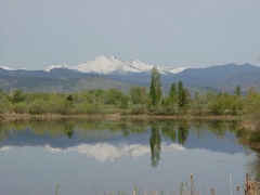
Longmont's St. Vrain Greenway recently re-opened all the way east to Sandstone Ranch, after being closed for 4.8 years due to damage from the 2013 flood. Finally got back out there on the bike today to check it out.
Before the flood, the Greenway to Sandstone was a popular bike ride and hike, especially on weekends. But it's been fenced off first at County Road 1 right after the flood and then in 2015, it was extended 1/2 mile east of CR1 for a few more years.
This was the the previous eastern-most point. The gate was closed and you can still see the leftover "No Trespassing" sign. Gate is open now!
The wetland marsh still exists north of the Greenway as you go toward Sandstone:
The powerful 2013 flood created a new channel of the St. Vrain river out here. It was decided by the engineers and planners just to leave it as nature carved it out in the flood vs. trying to put the river back in it's pre-2013 shape. One reason I heard at a city open house was that wildlife had already adopted the new wetlands created by the river split. A new double-bridge was added over the new channel, kind of hard to see in this picture:
The smaller 2009 bridge remains over the original flow of the river as you cross into Sandstone Ranch:
I saw some wild turkeys after crossing the bridge into the park:
The cliffs at Sandstone:
I was glad to see my old favorite gravel road still there, going in front of the cliffs to the east and then up the hill. It's in rougher shape than I remember it with lots of loose sand. I wouldn't try it on skinny bike tires:
The view from the lookout point situated on top of the cliffs:
Hard to believe it's been over 1768 days since I've been able to ride the Greenway to Sandstone. Very glad it's back.

 One citizen's view of Longmont, Colorado, USA.


No comments:
Post a Comment