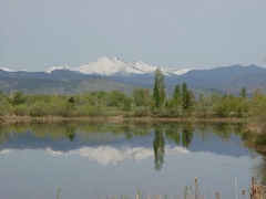
 One citizen's view of Longmont, Colorado, USA.
 The "2009 Longmont Water Quality Report", mailed to every residence a few weeks ago, mentions that we got 39% of our water last year from reservoirs in Grand County, across the mountains. Thanks to some very-forward thinking Longmont administrators who filed water rights claims over there in the 1960's, we are blessed with a very reliable supply of water. (Label to the left is from a water bottle handed out by friendly volunteers at last week's Rhythm on the River festival). Filled with Longmont water, of course!
Did you know that the Northern Colorado Water Conservancy District (NCWCD) offers a free tour, several times a year, of the facilities on the other side of the divide, where this water comes from? After years of seeing this offer go by, I finally signed up and took the tour last week. Very glad I did!
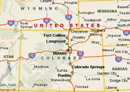
The West Slope Tour started on a Wednesday at NCWCD Headquarters in Berthoud at 7 AM. A cold front was coming through at this exact time and it was cool with some light rain just starting in Berthoud. After a quick warmup talk, you get on a bus which takes you through Loveland, Estes Park, Rocky Mountain National Park, and then over Trail Ridge Road. Throughout the ride, two informative NCWCD employees narrate points along the way, including historical information and spotting wildlife.
The actual route that we took:

At a short stop at the Rocky Mountain National Park visitor's center. It's misty and cool, due to that cold front.

The ride across Trail Ridge went through patchy fog and mist, where you couldn't see anything out the window but sometimes there would be clearings, and things got much better almost immediately on the other side of the Divide.
Next stop was the site of the western end of the Alva B. Adams Tunnel, where our water flows through. Since 9/11, entrance to the tunnel is not permitted. Water flows downhill through the tunnel for 13 miles, and comes out southwest of Estes Park at Mary's Lake.

Grand Lake, right next to the tunnel entrance. As you can see, the weather was entirely different on this side of the mountains.


We were told at HQ that morning that the water levels over here were at a ten-year high and that the damn on nearby Lake Granby was close to spilling over into the Colorado River. The higher amounts of rain on the Front Range has so far lessened the need for water, thus the potential spillover.
Next and final stop (and for lunch) was at Windy Gap Reservoir. This is where our water is stored until it is needed. A pumping station here is periodically fired for moving water to Lake Granby and eventually through the tunnel. Longmont played a large role in the Windy Gap project.


After lunch at the Windy Gap facility, the tour is broken up into three groups which rotate between a presentation, visiting the pumping facilities, and the Wildlife area around the reservoir where you can sometimes see a moose or two.
Four floors down in the pumping room:

The presentation where NCWCD personnel will answer all of your questions!

And the Wildlife area:

We got back on the bus around 2:30 and headed back to Berthoud, making it back around 5:30 (we had some delays due to seasonal construction on Trail Ridge). Yes, it was still raining when we returned. Later that evening, Trail Ridge was actually closed for the night by authorities due to poor visibility from that rainy front, especially with some areas under construction.
There is also a separate NCWCD tour, visiting the facilities on this (east) side of the Divide, which I definitely plan to attend. Thanks to the tour facilitator on our bus, Brian Werner for the expert commentary and keeping things fun, and also to our bus driver for navigating the tricky weather.

No comments:
Post a Comment