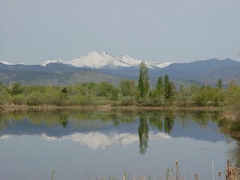
 One citizen's view of Longmont, Colorado, USA.

Winfield, Colorado is a ghost town in Chaffee County, roughly between Leadville and Buena Vista, in an area that is surrounded by 14'ers. Two things keep this 1890's abandoned silver-mining town from being forgotten:
- The Clear Creek Canyon Historical Society of Chaffee County has done a great job of preserving and labeling the remaining structures there.
- Winfield is the halfway turnaround point of the classic Leadville 100 (mile) running race. On a Saturday every August (this year on the 18th), more than a thousand people will visit Winfield, including runners, their pacers and crews, supporters, and race volunteers and officials.
 |
| CO-390 appoaching Winfield |


The Leadville 100 runners will approach an aid station here, where they can get refueled and pick up an optional pacer to run with them on part or all of the return trip to the finish line, if they choose. I happen to be partial pacer this year and will be helping my runner make it from Winfield to Twin Lakes, which involves a steep climb over Hope Pass, at 12,500 feet.
What follows is a short description of mile 50 to 60 of the race route, which I did for the first time two weeks ago in late July.
The climb up Hope Pass begins after a slightly two mile downhill going east of Winfield on CO-390. You'll see the Sheep Gulch trailhead sign on your left and a sign that shows that you're now on the Contintental Divide Trail:


And the
Looking south as I'm huffing and puffing up the climb. CO-390 is in the valley below:

Hope Pass straight ahead but I'm probably still 45 minutes and many switchbacks away. Hope Pass sits between two 13'ers, Mount Hope (13,933 feet) and Quail Mountain (13,461 feet).

Above treeline now, looking back the way I came, along a switchback:

Made it to the top! I'm looking north where in the distance, you can see Twin Lakes and north of that, Turquoise Lake. My destination is Twin Lakes which is five miles away. I'm also glad to be going down at this point (11 AM) because there is some serious cloud build-up starting to occur.

Nice artwork at the top:

Looking south to the Collegiate Peaks collection of 14'ers.


One last obstacle between the runners and Twin Lakes is the Arkansas River drainage. Runners have to wade through it, so naturally I did too. Luckily, the waters are not as high this year.

Knee-deep in the middle of the river, looking west:

About three hours from when I left Winfield, I made it to the store at Twin Lakes. Lots of Broad-tailed hummingbirds buzzing there, this one a female (sorry for the blurriness):

And sure enough, a thunderstorm with rain came through the Twin Lakes area around 1 PM.
I'll take some more pictures when I return to Winfield and Hope Pass next week.

3 comments:
Now I have to go to Winfield! I thought I had explored the Leadville/BV area fairly well, but I haven't been to this town.
Great pictures--I may have to hike that route too.
Jane, if you do the hike from the Winfield ghost town site, the Continental Divide Trail (CDT) has *very* recently been extended directly to Winfield via a new trail section that has been built by volunteers this summer. It's so new that I doubt it will be on maps yet but it allows Winfield <--> Hope Pass hikers to avoid the dusty jeep road entirely. It's a pleasant section of trail, maybe about 3.5 miles long that goes through a variety of landscape.
Oh, and four miles east of Winfield on the same road, there is another mining town (Vicksburg) that is worth checking out.
http://en.wikipedia.org/wiki/National_Register_of_Historic_Places_listings_in_Chaffee_County,_Colorado
Thanks for the info, Peter. We'll check it out.
Post a Comment